Tensions Between Economic Development, Planning Controls and Protection of Archaeological Heritage: Destruction of the Megaliths at Carnac
Posted on: August 3, 2023 by Marie Cornu
Carnac is one of the most important sites for megalithic architecture, protected in large part from the end of the nineteenth century as a historic monument under the Law of 30 March 1887, the first ever legislative text to introduce a binding legal regime in the area of heritage protection. Carnac appeared on the list of protected monuments of 1889. It is a site with 3,000 menhirs, or standing stones, aligned in an area of some four square kilometres. The question at issue here concerns the protection of aspects of archaeological heritage in the face of urban development, on a site which is likely to possess heritage value that should be protected: the Montauban road in the municipality of Carnac. This section of the megalithic site does not fall within the area which is classified as containing historic monuments, but it does appear on the Heritage Atlas, drawn up by the government department in the region. The Atlas is a tool for “dissemination of heritage data in a given area, accessible by all and free“.

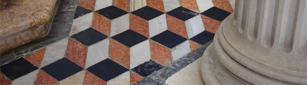
Carnac megalithic alignment
The Atlas identifies the sites which are protected by the Heritage Code: historic monuments, notable heritage sites, accredited places (e.g. ‘towns of art and history’, ‘houses of illustrious people’, ‘noteworthy gardens’), zones of presumptive archaeological restrictions and more generally those sites which are likely to possess cultural or heritage value. These might be archaeological entities which, while not being specifically protected, have been identified and registered as a heritage asset. The tool is intended for use by various services, including local authorities, where it can be used to assist with their knowledge of the area when carrying out their functions.
The Montauban road is a site which, while not protected, is identified as an archaeological entity. It could in the future be included as a UNESCO World Heritage site. Efforts are currently under way to have Carnac included on the international list. In 2022, a company obtained planning permission for the construction of a DIY store, entailing the destruction of 39 megaliths. Before this, in 2014, the same company had applied for planning permission to build a supermarket on the site. The local DRAC (Direction Régionale des Affaires Culturelles) was asked to advise. The prefect of the region was alerted to the possible archaeological interest of the site and ordered an investigation in accordance with the Heritage Code (Book V), naming INRAP (l’Institut National des Recherches Archéologiques Préventives) as the body to carry out the investigation. The prefectoral order noted that the proposed work was “likely to affect elements of the archaeological heritage” because of its location “in a sensitive area, not only at the heart of a dense archaeological environment (Gallo-Roman villas in Bosséno, a barrow at Kerfraval (a village in Brittany), a burial mound in Saint Cornély in Brittany, etc.) but also close to the Montauban site where archaeological survey excavations undertaken by INRAP revealed Neolithic occupation dated between 4900 and 4000 BCE” (Arrêté n° 2014-348 portant prescription de diagnostic archéologique, 22 décembre 2014). In the arsenal of provisions relating to archaeological surveys, the implementation of an archaeological survey “seeks, through investigations, surveys or field work, to identify elements of archaeological heritage which may be present on the site and to present the results of the survey in a report“.
The prefect recommended such a survey, following which a report was delivered in 2015 which concluded that it was possible that there was a previously unknown megalithic complex on the site. Although no remains had previously been found, the report emphasised that “against all odds, some remains were found. Hidden by thick and impenetrable tree growth, were two ancient plot boundaries, formed of low drystone walls, made of large upright granite blocks. Partial felling of the wood allowed identification of some twenty steles, arranged in a row“. “Only further observations on the monoliths, or even an excavation, would make it possible to certify the Neolithic origin of this ensemble“ the report stated. Following a favourable opinion from the inter-regional archaeology commission, the Brittany regional office ordered a dig over an area of 2,000 m2 at the site of the two rows of blocks. However, no action was taken on this order, in that the planning permission for the supermarket was refused. This was for reasons other than the site’s archaeological importance (height of the building and presence of a wetland area). The order was then forgotten.
For this new application, the town council said it had relied on various opinions, in particular that of an architect from Bâtiments de France, which in this instance delivered a favourable opinion. Opinions clearly differ greatly on the appreciation of the archaeological interest of this site. Some protagonists are very critical, arguing that the archaeological value of these alignments is crucial.
Others are more moderate, considering that archaeological investigations could have been ordered, as recommended in the report following the heritage survey. No detailed analysis was carried out on the site: “There is much uncertainty. Of the 40 stones on the site, are some of them genuine? Without a dig, we cannot know“. DRAC, in a press release, stated that “by reason of the still uncertain nature and the minor significance of the remains as revealed by the survey, it has not been established that the site possesses any archaeological value“. In the absence of statutory requirements, one can only proceed on the basis of presumption. However, it would appear that not all the factors were taken into consideration in the decision-making process, as the town hall concedes.
Adaptations could no doubt have been considered – all the more so since no construction work was carried out on that part of the site where the archaeology was destroyed. The case shows the complexity involved in heritage decision making when faced with regional development projects and the absolute necessity to reconcile and co-ordinate the different levels of decision making.
Image Credits:
Carnac megalithic alignment, August 2004, CC 3.0 via Wikimedia Commons – File:Carnac megalith alignment 4.jpg – Wikimedia Commons